Honey, Stop the Car
Our guide to wildflower drives across Texas
From piney woods to high desert, from barrier islands to bayou, Texas offers plenty of variety in its 268,000 square miles of terrain. Factor in the nine major ecoregions and weather ranging from flood to drought, and the result is 5,000 species of flowering plants that are native to the Lone Star state. There are even six different species of bluebonnets, two of which grow naturally only here, including the Texas bluebonnet. Given this extreme abundance and diversity, you can imagine how difficult it is to select the best wildflower viewing routes for our state.
So we called in the experts, culling years of recommendations from Wildflower Center staff, Texas Highways magazine, Texas Monthly magazine, and our favorite guidebooks and websites. The result is a baker’s dozen of recommended routes throughout the state, all uniquely beautiful, with local blooms, scenic vistas, worthwhile detours and a bit of history too.
Whatever your destination, enjoy the beautiful Texas landscapes as they are blanketed with wildflowers, and remember that there is something lovely to behold at any time of the year. Appreciating nature is all about getting out there.
Explore by Region
PANHANDLE
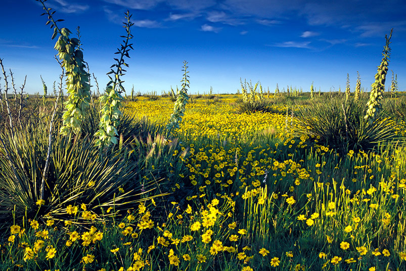
Yucca (Yucca sp.) and yellow daisies on US 385 near Hereford. Photo: Sam Barricklow
High Plains Loop
Along this 135-mile drive through the Panhandle high plains, look for sunflowers (Helianthus spp.), western tansymustard, Gordon’s bladderpod, nine-anther prairie clover, winecups (Callirhoe spp.), gayfeather (Liatris spp.), daisies and yucca. While in Amarillo, stop at the Wildcat Bluff Nature Center to see yellow puccoon, antelope horns, prairie verbena, prickly poppy (Argemone spp.), narrowleaf coneflower and more. The Lake Meredith National Recreation Area offers blackfoot daisy, lace cactus, chocolate daisy, American basketflower and copper globe mallow.
Directions: Take 87/287 north from Amarillo. Right on FM 1913 for 25 miles, then right again onto FM 1319. South 10 miles to Sanford, then 7 miles south to Fritch. Take TX 136 south back to Amarillo. Google Map it!
Pristine Prairie
The lake is dry and the bison no longer roam, but this refuge contains habitats ranging from riparian to marsh to woodland. The jewel of this 4,000-acre preserve is a swatch of high plains short grass prairie, a 175-acre National Natural Landmark. Look for prickly poppies, flowering cactus and sunflowers blooming from April through early June.
Directions: Take I-27 south from Amarillo. West on Rt. 60. South on FM 168 through the Refuge to FM 1075 east. Follow FM 1075 as it turns north and east toward the town of Happy, which brings you back to I-27. Google Map it!
– Back to List –
NORTHEAST TEXAS (TEXARKANA)
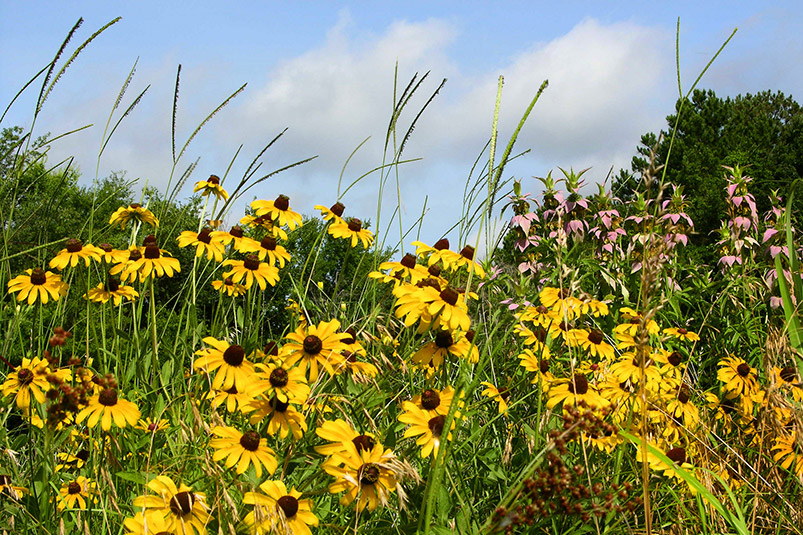
Black-eyed Susan (Rudbeckia hirta) and spotted beebalm (Monarda punctata) near Tyler on County Road 492, just off Hwy 69. Photo: K.N. Listman
Piney Woods and Bayou
The rolling hills of the piney woods, Caddo Lake bayous and the childhood home of Lady Bird Johnson highlight these East Texas drives.
The 40-mile triangle connecting Linden, Avinger and Hughes Springs is known for its yellow-fringed orchids, lobelia (Lobelia spp.), coralbean, coreopsis (Coreopsis spp.), Indian paintbrush and phlox (Phlox spp.). These communities host the Wildflower Trails of Texas (www.lindenwildflowertrails.net.) Along the woodland edge, look for yellow thistle, coreopsis and beardtongue (Penstemon spp.). Common rose mallow and stalks of giant coneflower can be found in low-lying areas. Texas bluebonnets, Mexican hats and wild indigo (Baptisia spp.), often bloom along FM 2198 near Uncertain, as do larkspur (Delphinium spp.), black-eyed Susans and butterfly weed (Asclepias spp.).
Add the towns of Atlanta, Karnack and Marshall and the route grows to 120 miles. Along the expanded route, look for coneflower, dogwoods, field pansy, Indian blanket, spiderwort (Tradescantia spp.), Mexican hats, bluebonnets and wild indigo. A detour at Karnack to Caddo Lake State Park leads to the only naturally formed large lake in Texas, home to bladderwort (Utricularia spp.), Carolina cabomba, fragrant water lily and American lotus.
Directions: From Marshall, north along Texas 43, then right onto FM 134 toward Karnack. Head into Karnack for a pit stop or turn directly left on FM 2606/TJ Taylor Avenue. Turn right on FM 2198 to Uncertain. Visit Caddo Lake State Park on your way back to Texas 43, which takes you north to Atlanta. Then US 59 to Linden. Texas 155 to Avinger, then Texas 49 to Jefferson. Then US 59 back to Marshall. Google Map it!
– Back to List –
EAST TEXAS
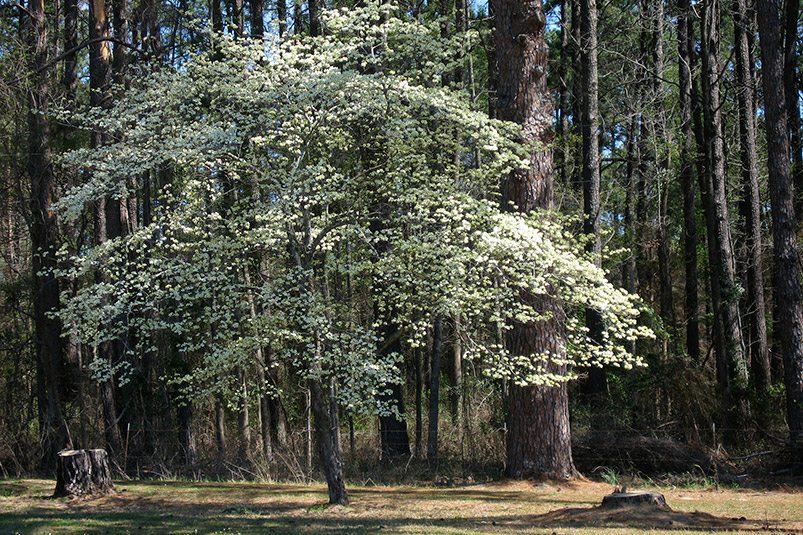
Flowering dogwood (Cornus florida) along FM 2198 just west of the Caddo Lake State Park entrance. Photo: Jerry Brown
Dogwood Heaven
This figure eight loop from Nacogdoches to Palestine offers the highest concentration of flowering dogwoods anywhere in the state. In Palestine, the 254-acre Davey Dogwood Park is awash in bloom during the Dogwood Festival, the last two weekends in March and the first weekend in April. Nacogdoches, the oldest town in Texas, features the Pineywoods Native Plant Center, where winecups, Indian paintbrush, coreopsis and evening primrose (Oenothera spp.) are easy to identify. Big Slough Wilderness Area near the northeastern tip of Davy Crockett National Forest, contains four distinctly different plant associations: short leaf pine and southern red oak; loblolly pine, white oak and shagbark hickory; water oak, willow oak and loblolly pine; and overcup oak, mayhaw and planer tree, some of which have never been forested. During wet periods it is possible to canoe a four-mile loop from the Neches to Big Slough and back.
Directions Loop One: From Palestine, east on US 84 to Rusk. Then south on US 69 to Alto. Skirt border of Davy Crockett National Forest on Texas 21 to Crockett. Then back to Palestine on US 287. Google Map it!
Loop Two: Take TX 21 west from Nacogdoches to Weches. FM 227 south to Ratcliff. Then TX 7 back to Nacogdoches. Google Map it!
– Back to List –
GREATER HOUSTON
Texas bluebonnets (Lupinus texensis) along Brenham’s Loop. Photo: MVX.
Beautiful Brazoria County
This 70-mile loop leads to one state park and two national wildlife refuges. Brazos Bend State Park boasts an incredible variety of wildflowers including Texas spider lily, floating bladderwort (Utricularia spp.), basket flower, black-eyed Susan, bluebonnets, morning glory vine (Ipomoea spp.) and wild indigo. At Brazoria National Wildlife Refuge, look for sea oxeye daisy, tropical sage, coreopsis, yellow thistle and spider lily, as well as sedges, rushes and cattails (Typha spp.). At the San Bernard National Wildlife refuge, keep an eye out for sea oxeye daisy along with irises (Iris spp.) and water lilies (Nymphaea spp.) and the state champion live oak tree. For more wildflowers, continue driving south to Quintana Beach County Park and check out the dunes.
Directions: From Houston, take TX 288 south to FM 1462. Go right (west). At Damon, head south on to Texas 36 through West Columbia to FM 2004. Rejoin Texas 288 near Lake Jackson. Google Map it!
Brenham’s Bluebonnet Loop
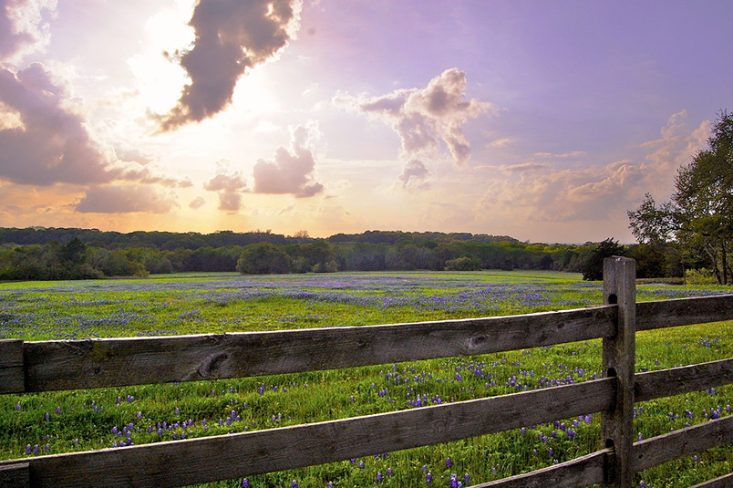
Fields of bluebonnets can be found on two different routes through the countryside outside Houston. An 80-mile, figure eight drive through Washington County, rolls from Brenham to Burton, Independence, Washington and Chappell Hill then back to Brenham. Expect fields full of bluebonnets, plus coneflower (Echinacea spp.), prairie verbena, beardtongue (Penstemon spp.), coral bean, skullcaps (Scutellaria spp.), prairie parsley, Indian paintbrush, blue-eyed grass (Sisyrhinchium spp.), rattlesnake flower, blanket flower and rosinweed (Silphium spp.).
Directions: From Brenham, northeast on TX 105. Then right onto FM 1155 south to Chappell Hill. Right on US 290, take Austin exit in Brenham to stay on 290 for 14 miles. Take turn off to Burton, FM 1697, then right onto FM 390. Proceed to Old Baylor Park in Independence. Turn right on FM 50, back to Texas 105 and Brenham. Google Map it!
For a more leisurely tour, consider the 105-mile loop through Washington and Grimes Counties. It transitions from stands of oaks to pine forests.
Directions: Starting in Brenham, take TX 105 through Navasota to Plantersville. Then south on FM 1774 to Magnolia and west on FM 1488 to Hempstead. Hop on US 290 north of Hempstead to return west to Brenham. Take note of the jog in the road at Navasota that takes drivers along the access road for Texas 6 to get to the adjoining portion of Texas 105. Google Map it!
– Back to List –
SAN ANTONIO AREA
Huisache daisy (Amblyolepis setigera), prairie verbena (Glandularia bipinnatifida) and prickly-poppy (Argemone sp.) between Hondo and Bandera on TX 173. Photo: Brad D. Cole.
Official Wildflower Capital
Visit DeWitt County, the Wildflower Capital of Texas, on the 132-mile loop southeast of San Antonio. Bluebonnets, Indian paintbrush, Mexican hats, Indian blankets, lazy daisies (Aphanostephus spp.), phlox, winecups and coreopsis are among the more than 1,000 different species that have been documented here. Consider a detour to Goliad State Park. Stop by the Cuero Chamber of Commerce for a map of more than 800 miles of wildflower trails and current updates. To see blooms at a slower pace, check out an April wildflower bicycling tour in Cuero.
Directions: Head southeast from San Antonio on US 181 to Kenedy. Then north on FM 792 to Texas 80 just south of Helena. Proceed north to Nixon, then head east on US 87 toward Westhoff. Continue south on 87 until it meets US 183/US 77A to Goliad. Then return to Kenedy via TX 239 East. Google Map it!
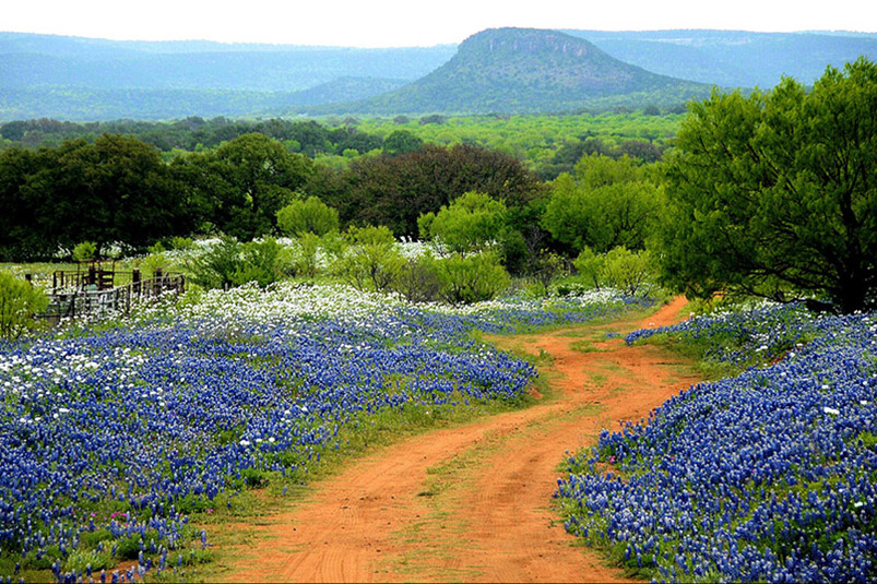
Cowboy Capital: The Bandera Loop
This 100-mile loop through the rugged county west of San Antonio crisscrosses the Medina and Sabinal rivers, rises in elevation to 2,150 feet and offers acres of blooms on scenic back roads. Look for such Hill Country favorites as bluebonnets, Indian Paintbrush, phlox, coreopsis, prickly poppies, sunflowers, firewheels, winecups and verbena.
Directions: Head northwest from Bandera on TX 16. In Medina go west on FM 337 to Vanderpool and Leakey. In Leakey turn south on Hwy 83 to Garner State Park. Turn Left on FM 1050 to Utopia. Turn left on FM 187 in Utopia. Turn right, heading north/northeast, on FM 470 to Tarpley. Continue on FM 470 to TX 16 and turn right to Bandera. Google Map it!
– Back to List –
HILL COUNTRY
Texas bluebonnet (Lupinus texensis) and prickly-poppy (Argemone sp.) along Willow City Loop. Photo: Joey McKay.
Willow City Loop
Just outside of Fredericksburg is one of the most cherished scenic drives of the Hill Country. Drive through rolling hills, canyons and steep outcrops on this slow, 13-mile two-lane ranch road through some of oldest geology in Central Texas. Depending on rainfall, expect to see bluebonnets, Indian paintbrush, phlox, coreopsis, prickly poppies, sunflowers, firewheels, winecups and prairie verbena in the spring. Caution: Heavy traffic on weekends. Land beside road is privately owned, so no stopping or parking along the route.
Directions: From Fredericksburg, head north on TX 16 for approximately 13 miles, go east on Ranch Road 1323 for nearly 3 miles to Willow City, then turn left onto Willow City Loop. Return to Fredericksburg via TX 16. Google Map it!
– Back to List –
SOUTHWEST TEXAS
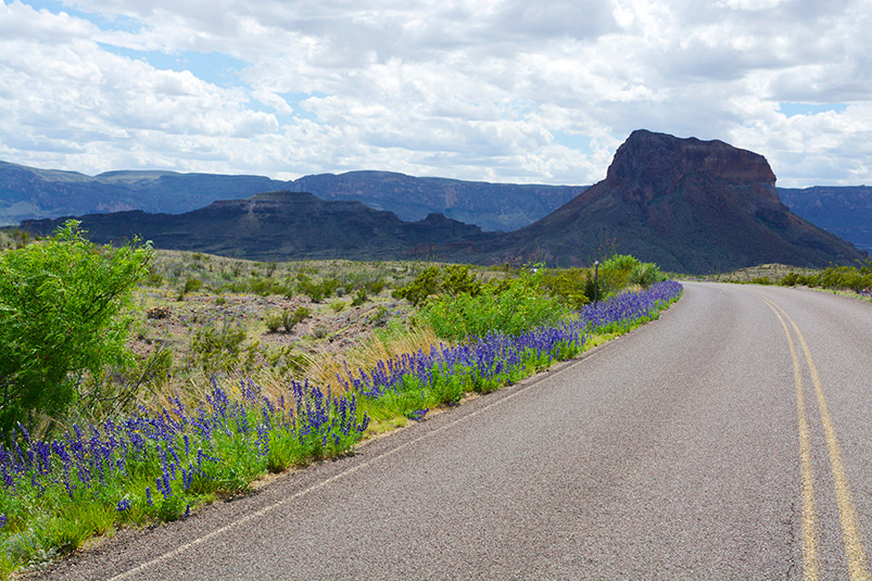
Big Bend bluebonnet (Lupinus havardii) in Big Bend National Park. Photo: Tracy Colvin.
Bigger in Big Bend
This route makes a 230-mile scenic loop through Alpine, Terlingua, Lajitas, Presidio and Marfa. Big Bend is mountainous desert, with cactus, strawberry pitaya (Echinocereus spp.), ocotillo, yucca and sotol (Dasylirion spp.), catclaw (Acacia spp.) and desert marigolds in bloom. The Big Bend bluebonnets are bigger than the ones you’ll find in the Hill Country. Since the flowers are so dependent on rain, in drier years look for unpaved roads, canyons and arroyos, which may have areas of accumulated moisture to feed the flowers. U.S. 385 from Marathon provides a scenic 40-mile drive to or from the national park. For more area information, go to www.visitbigbend.com.
Directions: From Marfa, south on US 67 to Presidio. Then FM 170 Camino Rio along the Rio Grande through Big Bend State Park to Terlingua and Study Butte. Take TX 118 north to Alpine, then return to Marfa on US 67/90. Google Map it!
Davis Mountain Loop
The 75-mile Davis Mountains Scenic Loop provides a 2,000-foot elevation change and scenery ranging from grasslands to vast piñon and ponderosa forests. Nearly all the land is privately owned, so please do not trespass. The Davis Mountains contains flora and fauna that exist nowhere else in Texas. Wildflowers here tend to bloom with the late summer rains. Along the loop, look for agaves (Agave spp.), bear grass (Nolina spp.), purple feather dalea, Mexican buckeye, flame leaf sumac, scarlet bouvardia, yellow bladder pods (Lesquerella spp.), white-flowered peppergrass (Lepidium spp.) and prairie verbena. At Davis Mountains State Park, look for scarlet bouvardia, trompillo, sumacs (Rhus spp.), Apache plume, cholla, yucca, cat claw acacia and agarita and other shrubs in bloom. Flowers may fill the park in years of abundant rainfall. When near Fort Davis, travelers can turn southeast onto Texas 118 for a short drive to see the plants at the Chihuahuan Desert Research Center.
Directions: From Fort Davis, head south two miles to TX 166. Proceed west and then north on TX 166 to TX 118, then right to return to Fort Davis. Google Map it!
– Back to List –
For more information about Texas wildflowers, visit Texas Wildflower Central.
Wildflowers are unpredictable, so call ahead to the local chamber of commerce or convention and visitors bureau to determine the best time to take the trip and the most productive routes.