Special Collections
Edwards Plateau
The Edwards Plateau area includes 1.45 million acres known as the Granitic Central Basin in Llano and Mason Counties. The Balcones Escarpment forms the distinct boundary of the Edwards Plateau on its eastern and southern borders and outlines what is known as the Texas Hill Country.The area is a deeply dissected, rapidly drained stony plain having broad, flat to undulating divides. Prior to modern settlement, vegetation was grassland or open savannah-type plains with tree or brushy species found along rocky slopes and stream bottoms.
Printer Friendly: Species List | List with Images | List with QR Tags to Mobile
| scientific name | common name(s) | image gallery |
| Baccharis neglecta | False Willow Jara Dulce Poverty Weed Roosevelt Weed | |
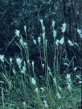
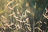
| Bothriochloa barbinodis | Pinhole Bluestem Cane Bluestem Cane Beardgrass Feather Bluestem Plains Beardgrass | |
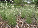
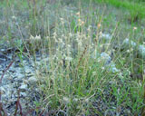
| Bouteloua curtipendula | Sideoats Grama Banderilla Banderita Navajita | |
| Bouteloua dactyloides | Buffalograss Buffalo Grass | |
| Bouteloua eriopoda | Black Grama | |
| Bouteloua gracilis | Blue Grama | |
| Bouteloua hirsuta | Hairy Grama | |
| Bouteloua hirsuta var. pectinata | Tall Grama Hairy Grama | |
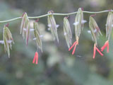
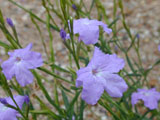
| Bouchea linifolia | Groovestem Bouchea Flaxleaf Bouchea | |
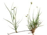
| Bouteloua rigidiseta | Texas Grama | |
| scientific name | common name(s) | image gallery |