Special Collections
Rolling Plains
The Rolling Plains area (24 million acres) coincides with the Rolling Plains land resource area of the southern Central Lowlands. The area is between the High Plains and the Cross Timbers and Prairies in the northern part of the state. It is a nearly level to rolling plain having moderate to rapid surface drainage. Soils of the uplands are pale brown to reddish brown to dark grayish brown, neutral to calcareous sandy loams, clay loams, and clays. Saline soils are common, as are shallow and stony soils with pockets of deep sand. Bottomlands have only minor areas of reddish brown, loamy to clayey, calcareous alluvial soils.Printer Friendly: Species List | List with Images | List with QR Tags to Mobile
| scientific name | common name(s) | image gallery |
| Baccharis neglecta | False Willow Jara Dulce Poverty Weed Roosevelt Weed | |
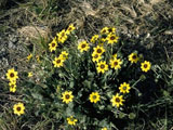
| Berlandiera lyrata | Chocolate Daisy Chocolate Flower Lyreleaf Greeneyes Green-eyed Lyre Leaf | |
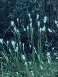
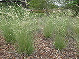
| Bothriochloa barbinodis | Pinhole Bluestem Cane Bluestem Cane Beardgrass Feather Bluestem Plains Beardgrass | |
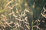
| Bouteloua curtipendula | Sideoats Grama Banderilla Banderita Navajita | |
| Bouteloua dactyloides | Buffalograss Buffalo Grass | |
| Bouteloua eriopoda | Black Grama | |
| Bouteloua gracilis | Blue Grama | |
| Bouteloua hirsuta | Hairy Grama | |
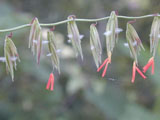
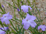
| Bouchea linifolia | Groovestem Bouchea Flaxleaf Bouchea | |
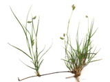
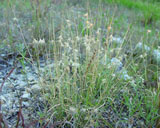
| Bouteloua rigidiseta | Texas Grama | |
| scientific name | common name(s) | image gallery |